Overview
Open between 5 a.m. and 10 p.m. unless otherwise posted or permitted.
2250 Isherwood Way, Fremont, CA 94536
(510) 544-3137
Toll Free: 888-EBPARKS (888-327-2757), option 3, ext. 4501
Trail Attributes
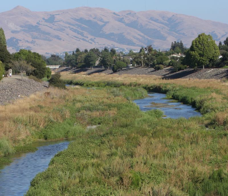
The Alameda Creek Regional Trail follows the banks of Alameda Creek in southern Alameda County from the mouth of Niles Canyon (in the Niles District of Fremont) westward to San Francisco Bay - a distance of about 12 miles.
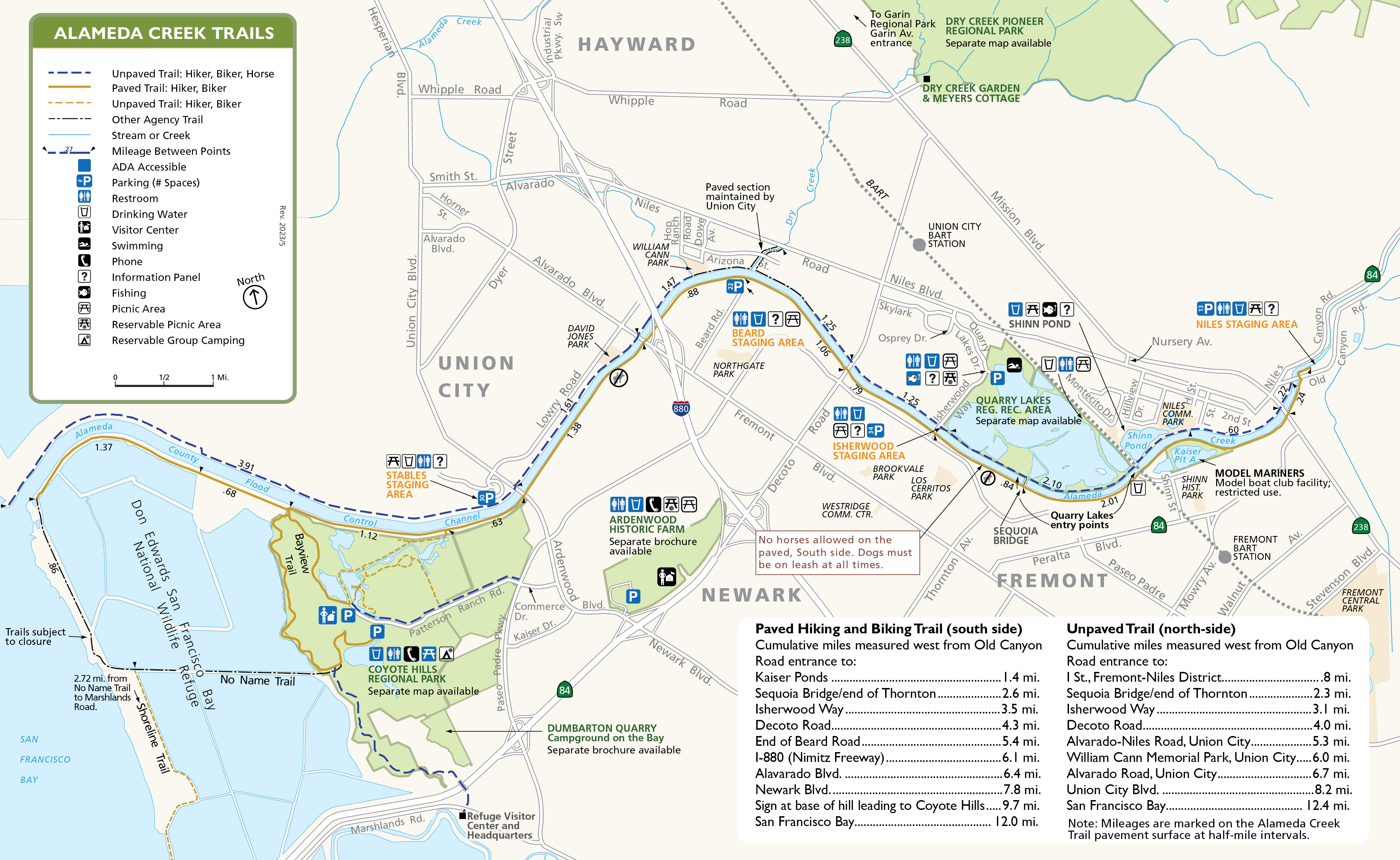
The trail on the south bank provides access to Coyote Hills Regional Park. An additional 3.5-mile-loop trail off the Alameda Creek Trail, into and out of Coyote Hills, and back onto the Alameda Creek Trail, qualifies in distance for marathon runs. For those who want to clock shorter distances along the trail, markers have been installed at quarter-mile intervals.
The trail is accessible from several thoroughfares in Fremont, Union City, and Newark. MOTOR VEHICLES ARE NOT ALLOWED ON THE TRAIL. Note: Class 1 and Class 2 e-bikes are currently allowed on paved sections.
To Reach the Trail
Maps
Trail Accessibility
Both the north-side trail and south-side trail are wheelchair accessible. The south-side trail is paved and the north-side trail is unpaved.
Trail Activities
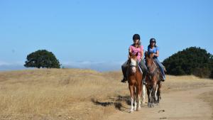
The south-side trail is recommended for bicyclers, hikers, joggers, and runners. The north-side trail is designed for horseback riding. Note that there is no direct access to Coyote Hills Regional Park from the trail on the north side of the creek. Bicyclists must wear a helmet and must ring a bell or call out to warn other trail users as you approach from behind.
Mileage
Trail Mileage Guides
- Download: Alameda Creek Trail - Paved
- Download: Alameda Creek Trail - Unpaved
North Side Equestrian Trail
| Cumulative miles measured west from Old Canyon Road entrance to: | Mileage |
|---|---|
| L St., Fremont - Niles District | .8 mi. |
| Concrete bridge/end of Thornton | 2.3 mi. |
| Isherwood Way | 3.1 mi. |
| Decoto Road | 4.0 mi. |
| Alvarado Niles Road, Union City | 5.3 mi. |
| New Haven Park, Union City | 6.0 mi. |
| Alvarado Road, Union City | 6.7 mi |
| Union City Blvd. | 8.2 mi. |
| San Francisco Bay | 12.4 mi |
South Side Bicycling, Hiking Trail
| Cumulative miles measured west from Old Canyon Road entrance to: | Mileage |
|---|---|
| Kaiser Ponds | 1.4 mi. |
| Concrete bridge/end of Thornton | 2.6 mi. |
| Isherwood Way | 3.5 mi. |
| Decoto Road | 4.3 mi. |
| End of Beard Road | 5.4 mi. |
| I-880 (Nimitz Freeway) | 6.1 mi. |
| Alvarado Blvd. | 6.4 mi. |
| Newark Blvd. | 7.8 mi. |
| Sign at base of the hill leading to Coyote Hills | 9.7 mi. |
| San Francisco Bay | 12.0 mi. |
History
Alameda Creek is Alameda County's largest and is home to a host of birds and other wildlife. Long ago its rushing waters provided a valuable resource for the Ohlone Indians who first settled in camps and villages along its banks. For information about Ohlone shellmound tours and Native American studies at Coyote Hills Regional Park, phone the Visitor Center at (510) 544-3220.
The area was visited and explored by members of five Spanish expeditions led by Ortega, Fages, de Anza, and Amador between 1769 and 1795. Mission San Jose de Guadalupe, located near the intersection of Washington and Mission boulevards, was dedicated in 1797. The 30,000-acre mission thrived for 49 years until the Secularization Order liquidated mission lands in 1834.
After secularization, the mission acreage fell into private ownership. Corruption grew, and in 1846 the lands of Mission San Jose were sold by the governor for $12,000 to Juan Alvarado. This sale was declared fraudulent in 1858 in United States courts and the lands became part of public domain.
Alameda Creek was the boundary of the mission lands and the 17,000-acre Rancho Arroyo de la Alameda was granted to Jose de Jesus Vallejo. Construction of a flour mill near the mouth of Niles Canyon by Vallejo, plus the importance of the canyon as a passage through the hills, led to the growth of a small town (today known as Niles) in the 1850s.
A favorable climate, excellent soils, and a fast-growing population helped agriculture to boom. Early roads led to landings where small ships would load grain and other foodstuffs for transport to market. Completion of the transcontinental Central Pacific railroad through Niles Canyon in 1869, and the Western Pacific in 1906, improved the situation for shipment of goods -- a service that is still beneficial to the area.
Movie making came to the Niles district for a short stay during World War I, when the Essanay movie production company moved in. Charlie Chaplin, Ben Turpin, Gloria Swanson, and others got their start in movies in Niles before the industry settled in Hollywood.
Quarrying for gravel was an early industry in this area and continues today.
The Alameda Creek Trail opened in January 1973. The project was funded by the U.S. Army Corps of Engineers, the Alameda County Flood Control and Water Conservation District, and the East Bay Regional Park District.
Quarry Lakes Regional Recreation Area is located alongside Alameda Creek and the Alameda Creek Regional Trail. Quarry Lakes has many water-oriented activities, including fishing, boating, swimming, and nature study.
Interpretive Panels
View a gallery of the Interpretive Panels located at various locations along the Alameda Creek Regional Trail.
Non-Emergency Trail Safety Hazards or Damaged Trails/Facilities: Locate a park ranger or call Public Safety Dispatch at (510) 881-1833. Be sure to mention the nature and exact location of the problem including the trail or area name.
Trail Conflicts/Violations: Call (510) 881-1833 for the Non-Emergency Public Safety Line, 24 hours a day, or submit a Park Watch Report online.
Emergency/Crime in Progress: Call 911 or (510) 881-1121 from a cell, 24 hours a day.
