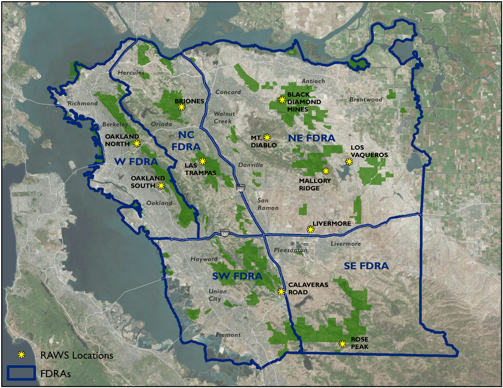
The Regional Parks are divided into five Fire Danger Rating Areas (FDRA): North Central, North East, South East, South West, and West. The weather, fire fuels, and other conditions that determine fire danger within each FDRA are generally the same.
Parks Within Fire Danger Rating Areas
North Central
- Little Hills
- Radke Martinez Shoreline
- Rancho Pinole
- Sycamore Valley
North East
- Antioch/Oakley Shoreline
- Bay Point
- Big Break
- Black Diamond Mines
- Browns Island
- Brushy Peak
- Byron Vernal Pools
- Castle Rock
- Clayton Ranch
- Contra Loma
- Deer Valley
- Delta Landbank
- Diablo Foothills
- Doolan Canyon
South East
- Camp Arroyo
- Camp Ohlone
- Del Valle
- Ohlone Wilderness
- Shadow Cliffs
South West
- Alameda Creek Trail
- Ardenwood Farm
- Coyote Hills
- Don Castro
- Dry Creek Pioneer
- Dublin Hills
- Garin
- Hayward Shoreline
- Mission Peak
- Monument Peak
- Palomares Ridge
- Pleasanton Ridge
- Quarry Lakes
- Sunol
- Vargas Plateau
West
Map of Fire Danger Rating Areas
- W FDRA = WEST Fire Danger Rating Area
- NE FDRA = NORTH EAST Fire Danger Rating Area
- NC FDRA = NORTH CENTRAL Fire Danger Rating Area
- SW FDRA = SOUTH WEST Fire Danger Rating Area
- SE FDRA = SOUTH EAST Fire Danger Rating Area

RAW Stations
View East Bay Regional Park District - RAW Stations indicated on the map by yellow pins [Google Map].
Weather data gathered from these areas by Remote Automated Weather Stations (RAWS) are used to determine the likelihood of a damaging and dangerous fire.

