Overview
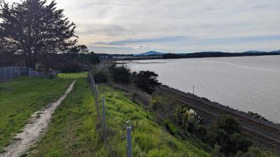
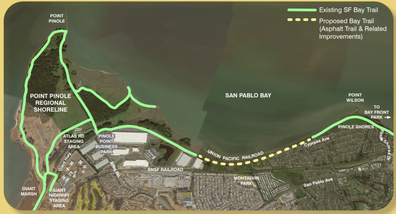
The Richmond Bay Trail Gap Closure Project (Project) will construct a 0.9 mile, paved multi-use segment of the San Francisco Bay Trail that will parallel the shoreline between Point Pinole and Wilson Point, closing a critical gap between the cities of Richmond and Hercules. The project will provide first-time public access to this part of the shoreline. A preliminary engineering study examining alignment opportunities and constraints, impacts of the trail, and costs to construct was completed in 2005.
In 2021 the Park District began the next phase of design to determine the exact alignment and identify potential impacts to utilities that share portions of the proposed trail corridor. The Park District consultants are now undergoing studies pursuant to CEQA in an effort to release a document for public review in early 2025. The project will also explore public access opportunities to connect local communities to the 0.9 mile stretch of Bay Trail.

Site Description

The trail is a proposed .9-mile segment between Pinole Point Business Park at Atlas Road to the current terminus of the Bay Trail near Wilson Point and the Pinole Shores Staging Area. The trail will lie within an easement granted by the various property owners including the businesses within the Pinole Point Business Park, Contra Costa County, and the Union Pacific Railroad (UPRR). Easements may also be required from the West Contra Costa County School District. The Park District owns the remainder of the property in the project area.
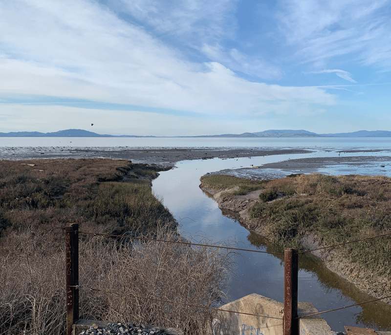
The trail corridor contains wetlands, utilities, and traverses a steep slope between private property and UPRR land, making the design challenging and technical in places. It is likely that there will be concrete retaining walls and boardwalks to address these challenges and the project will aim to minimize impacts to natural and cultural resources.
The project traverses the northern boundaries of the Montara Bay Community Park and the former site of Seaview Elementary School.
Public Outreach
In the summer of 2023, the Park District released a survey to learn more about the public’s interest in this project. The survey was accessible via QR code and was posted at various parks, centers of employment, and neighborhoods within the vicinity of the project. Responses were largely positive and indicated that this gap closure would increase the usability of the Bay Trail in this area. Over 475 people submitted responses. Of those, 95% said they would use this section of Bay Trail, and 86% responded that closing this gap would be very beneficial to the local area.
The Park District also reached out to the neighbors immediately adjacent to the project. Primary concerns expressed include safety and security, slope stability, potential traffic, and viewshed. The design of the project will take into account these concerns.
Timeline
The Park District’s Board of Directors awarded a contract to BKF Engineers in late 2021 for the preliminary design, specifically as it relates to utility location and coordination, and environmental services including studies pursuant to CEQA. It is anticipated that the preliminary design and CEQA document will be released for public review in 2025.
San Francisco Bay Trail Extension Project Survey
Tell us how you currently use the SF Bay Trail and how you might use the trail in the future.

