Overview
Park Curfew: 10 p.m. - 5 a.m.
Park Gate Hours:
January - February: 7 a.m. - 6 p.m.
March: 7 a.m. - 7 p.m.
April - September: 8 a.m. - 8 p.m.
October: 8 a.m. - 7 p.m.
Nov. 1 - 27: 8 a.m. - 6 p.m.
Nov. 28 - Dec. 31: 7 a.m. - 6 p.m.
Visitor Center hours:
10 a.m. - 4 p.m., Wednesday - Sunday
Open: Memorial Day, July 4, and Labor Day
Closed: Jan. 8, April 9, Aug. 13, Dec. 10, Thanksgiving, Christmas Eve and Day, New Year's Eve and Day
Parking:
$5 per vehicle
$4 per trailered vehicle
$25 per bus
8000 Patterson Ranch Road, Fremont, CA 94555
(510) 544-3220
Toll Free: 888-EBPARKS (888-327-2757), option 3, extension 4519
Internet & Cellular Access

Check AT&T, T-Mobile & Verizon Coverage.
Select 'Map Layers' and switch on 'No Data Coverage Areas'
Park Activities
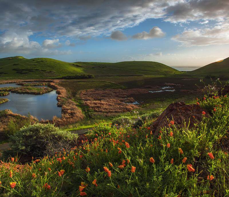
Coyote Hills Regional Park was dedicated in 1967. The park comprises 1,266 acres of marshland and rolling grassland-covered hills. This busy park is located along the eastern shore of San Francisco Bay, northwest of the cities of Fremont and Newark. The most popular visitor activities are hiking, jogging, bicycling, bird watching, nature exploration, and picnicking. Well used every season of the year -- spring, summer, and fall tend to be the most popular. But the park's winter beauty is wonderful to behold.
Chochenyo Trail Names
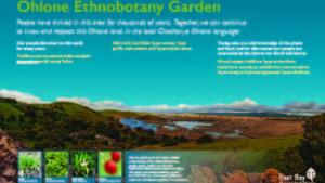
On Sunday, November 27, 2022, the Park District celebrated the updating of 35 trail markers at Coyote Hills Regional Park to include trail names in Chochenyo, the language of the park’s First Peoples. Coyote Hills – Máyyan Šaatošikma – is the ancestral homeland of the Tuibun Ohlone peoples, who have thrived with the land and spoken the Chochenyo language since time immemorial. The celebration included the unveiling of the first new trail markers that include Chochenyo trail names, with the remaining trail posts being installed and replaced over the next six months. The Muwékma Ohlone Tribe Language Committee began working on this Chochenyo Trail Marker Project in 2016 and the first signs were unveiled in November 2022 to coincide with Native American Heritage Month. The new trail markers include an emblem that lists translated Chochenyo trail names. The new trail markers honor a request by Muwekma Ohlone Tribe to restore original place names at Coyote Hills and integrate them into park signage. The trail markers are also an important interpretive feature for ongoing interpretive programming.
Chochenyo Translations of Trails:
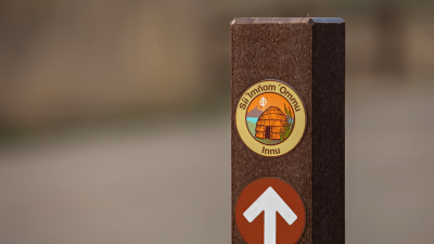
- Bayview Trail = Síi ’Imñom ’Ommu
- Lizard Rock Trail = ’Ipíhwa ’írek
- Meadowlark Trail = Čiirikimin
- Muskrat Trail = Ramés
- Peregrine Trail = Kaknu
- Quail Trail = Hekšen
- Red Hill Trail = Púltéewis Šáatoš
- Soaproot Trail = Rawwen
- Willows Trail = Ríipinikma
Landmark Names:
- Heron Marsh = ’Áareh Marsh
- Lark Marsh = Čiirikimin Marsh
- Peregrine Marsh = Kaknu Marsh
- Willow Marsh = Ríipinikma Marsh
Learn more about the Great Work that Native People are Doing Throughout the Bay Area (PDF)
Restoration and Public Access Project
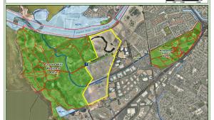
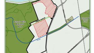
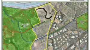
- Construction for this project is anticipated to be completed in Summer 2024. Additional information can be found on the project webpage.
- Coyote Hills Project Brochure [PDF]

Coyote Hills Naturalist Programs
Join us for our monthly programs!
To Reach The Park
Maps
Park Accessibility
There are two disabled parking sites at the Visitor Center's parking lot. Both of the public restrooms at the Center have an accessible stall. Drinking fountains located near the Visitor Center have been upgraded to meet current ADA standards. There is one wheelchair accessible chemical toilet in the Center's parking lot and one at the Quarry Staging Area. The Dairy Glen campsite is now fully ADA compliant including a new hardened path that makes it easier for guests using wheelchairs and mobility devices to access the shade structures and other components of the camp. Public transit information.
Accessibility Resources
Access Northern California, in partnership with BORP, provides information related to accessibility at Coyote Hills Regional Park. Access Northern California Coyote Hills Regional Park Accessibility Page
(Disclaimer: The Park District has not reviewed and does not guarantee the accuracy of the information provided by Access Northern California Accessibility.)
Attractions
Visitor Center
Coyote Hills Visitor Center contains educational displays and exhibits as well as the Possum's Pocket Nature Store. The exhibits portray the Ohlone way of life and include a tule reed boat constructed by park staff and volunteers using Native American methods. Other exhibits cover the park's natural history and wildlife.
Naturalist-led programs, including tours of the marsh and surrounding area, highlight the park’s cultural and natural history. An annual Gathering of Ohlone Peoples highlights the ways today’s Ohlone's are bringing their cultures into the future. To learn more about the park’s history and natural wonders, or naturalist-led walks and other programs, visit the Visitor Center Wednesdays through Sundays, 10am - 4pm
Nectar Garden
A bird and butterfly nectar garden is located adjacent to the visitor center. Currently, the garden is open to the public Wednesday through Sunday, 10 am to 4 pm. Several naturalist-led educational programs are offered in the garden during the year. Contact the interpretive staff at (510) 544-3220 for additional information.
Picnicking
Numerous picnic tables are located at the visitor center and at the Quarry Staging Area on a first-come-first-served basis with barbeque braziers, water, and shade. Cooking fires are limited to the metal braziers provided at each site. The Hoot Hollow picnic area, located near the visitor center, is a reservable picnic site. Visit the Coyote Hills Picnic Area webpage for more information or call Reservations to reserve.
Camping
The Dairy Glen 50-person capacity group camp, named after the dairy farmers of the 1800s, has been completely upgraded and renovated thanks to funding from the Regional Parks Foundation. The group camp includes three shade structures, additional picnic tables, a drinking foundation, a fire pit, a hand washing station, and vault toilets. Upgrades created greater accessibility so the campsite is now fully ADA compliant including a new hardened path that makes it easier for guests using wheelchairs and mobility devices to access the shade structures and other components of the camp.
Reservations, made 3 or more business days in advance, are required. View the Camping page for more information, and call Reservations to reserve.
Hiking
Hikes through Coyote Hills afford scenic vistas of San Francisco Bay and surrounding areas of Southern Alameda County. Ramble 'round a marsh or climb to the top of Red Hill to catch the breeze. For detailed information on trail lengths and terrain, see the park map or talk with staff in the visitor center. Other attractions of interest include the Marsh Boardwalk and the 3.5-mile Bayview Trail, a paved loop trail for hiking and bicycle riding. There are wonderful scenic views of San Francisco Bay and the peninsula hills to the west from the park's hilltops.
Bicycling
Bike riders may take the 3.5-mile paved Bayview Trail within the park. Bayview connects with 12 additional miles of trail along the south levee of the Alameda Creek Trail, and to the Don Edwards San Francisco Bay National Wildlife Refuge.
Wildlife Refuge
The waters to the west and south of Coyote Hills are part of the Don Edwards San Francisco Bay National Wildlife Refuge, operated by the U.S. Fish and Wildlife Service. The Shoreline, No Name, Apay Way and Alameda Creek trails provide access to the Refuge for hikers and bicycle riders. Apay Way leads to the Refuge Visitor Center via a bridge over the top of the Highway 84/Dumbarton Bridge toll booths.
Alameda Creek Trail
This 12-mile trail stretches from the Bay east to the mouth of Niles Canyon and borders Coyote Hills on the park's north side. It is actually two parallel trails, with an equestrian trail on the northern levee and a bicycle trail on the southern levee, connecting with the Coyote Hills' Bay View bike trail. Hikers are welcome on both trails. Motor vehicles are not permitted on the trails--citations will be issued to violators.
Other attractions at Coyote Hills include the Marsh Boardwalk, and 3.5-mile Bay View Trail, a paved loop trail for hiking and bicycle riding. There are scenic views of the South Bay from the park's hilltops.
Environmental Education: Ohlone Youth Summit
Naturalist Programs
The park's naturalist staff conducts a variety of programs for both organized groups and the public. Programs are offered on a variety of subjects including, Native American history and culture, birds and butterflies, marsh and grassland ecology, and general nature exploration. Public programs, usually on weekends, are publicized in the Park District's monthly newsletter, Regional In Nature, which is available in the visitor center and posted on park bulletin boards. Weekday programs are available for schools and organized groups by reservation. Call (510) 544-3220 for further information.
Detailed descriptions of the Coyote Hills Naturalist Programs.
Nature Study
In addition to taking part in the naturalist programs publicized on park bulletin boards and in the Park District's monthly newsletter, you may want to strike out on your own. Bringing along a magnifying glass, camera, a pair of binoculars, and maybe a sketchbook will help to enhance your experience. Remember to wear sturdy walking shoes and bring liquids and a snack. Information about what to see and where to go is available in the visitor center.
Upcoming Events
History
The East Bay area's original inhabitants were the ancestors of the Ohlone Indians, hunters, and gatherers whose skills enabled them to live well off the land's natural bounty. In those days, tule elk roamed the land, condors soared overhead, and sea otters and fish were abundant in the Bay. At Coyote Hills Regional Park, some of this rich wetland is preserved, along with 2,000-year old Tuibun Ohlone Indian shellmound sites with fascinating archaeological resources.
The park's rich and varied history also includes Mission and settler ranching and farming activities, salt production, a duck hunting club, a dairy, rock quarrying, a military NIKE missile site, and a biosonar research facility. Now a Regional Park, this area is preserved for recreation, and educational and nature experiences for all to enjoy.
