
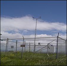
Remote Automated Weather Stations (RAWS) monitor the weather and provide weather data for Alameda and Contra Costa counties and form part of a nationwide RAWS network.
The data generated by RAWS can be used in a variety of ways. Fire Managers can predict fire behavior and track weather and fuel characteristics. Resource managers use the data to monitor environmental conditions. RAWS data are used to calculate fire danger and create fire precautions for areas though out the Park District. Park visitors can use it to learn about the current weather at local parks.
Four of the RAWS stations are monitored by The East Bay Regional Park District and are part of a network of over 10 RAWS stations throughout the two county areas. The other six are monitored by other agencies throughout the East Bay. Below is a table of information gathered by each RAW station and an interactive map of the RAW station at their locations.
For more information see the National Weather Service Interactive RAWS and METAR Observation Map.
| AREA | TABULAR DATA | GRAPHICAL DATA |
|---|---|---|
| Altamont | Read data | Read data |
| Black Diamond (BKD) | Read data | Read data |
| Briones (BNE) | Read data | Read data |
| Calaveras Road (CRD) | Read data | Read data |
| Las Trampas (LTR) | Read data | Read data |
| Mallory Ridge (MLR) | Read data | Read data |
| Byron | Read data | Read data |
| Oakland North (ONO) | Read data | Read data |
| Oakland South (OSO) | Read data | Read data |
| Rose Peak (RSP) | Read data | Read data |