
Overview
Park Curfew: 10 p.m. - 5 a.m.
Park/Gate Hours:
November - February: 8 a.m. - 5 p.m.
March: 8 a.m. - 6 p.m.
April: 8 a.m. - 7 p.m.
May - August: 8 a.m. - 8 p.m.
September: 8 a.m. - 7 p.m.
October: 8 a.m. - 6 p.m.
Parking: No fee
Fees subject to change.
1300 Crockett Blvd, Crockett, CA 94525
(510) 544-3122
Toll Free: 888-EBPARKS (888-327-2757), option 3, extension 4521
Internet & Cellular Access

Check AT&T, T-Mobile & Verizon Coverage.
Select 'Map Layers' and switch on 'No Data Coverage Areas'
Park Activities
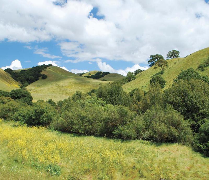
Located outside of the town of Crockett, the 2,124 acres of Crockett Hills Regional Park were likely hunting and gathering grounds for Native Americans, later were nineteenth century ranch-lands, and more recently were part of the industrial history of the region. The original ranch barn, milk-house, and corrals can still be seen in the Crockett Ranch staging and picnic area. The park ranges in elevation from 150-800 feet, offering views of San Pablo Bay, the Delta, Mount Tamalpais, and Mount Diablo. Trails include a 4.5-mile segment of the Bay Area Ridge Trail.
The topography of Crockett Hills Regional Park and the adjoining Carquinez Regional Shoreline consists of open, rolling grasslands, wooded ravines, eucalyptus-shaded meadows, and river shoreline. Multi-purpose trails provide access to canyon views and ridgetop vistas.
To Reach The Park
Maps
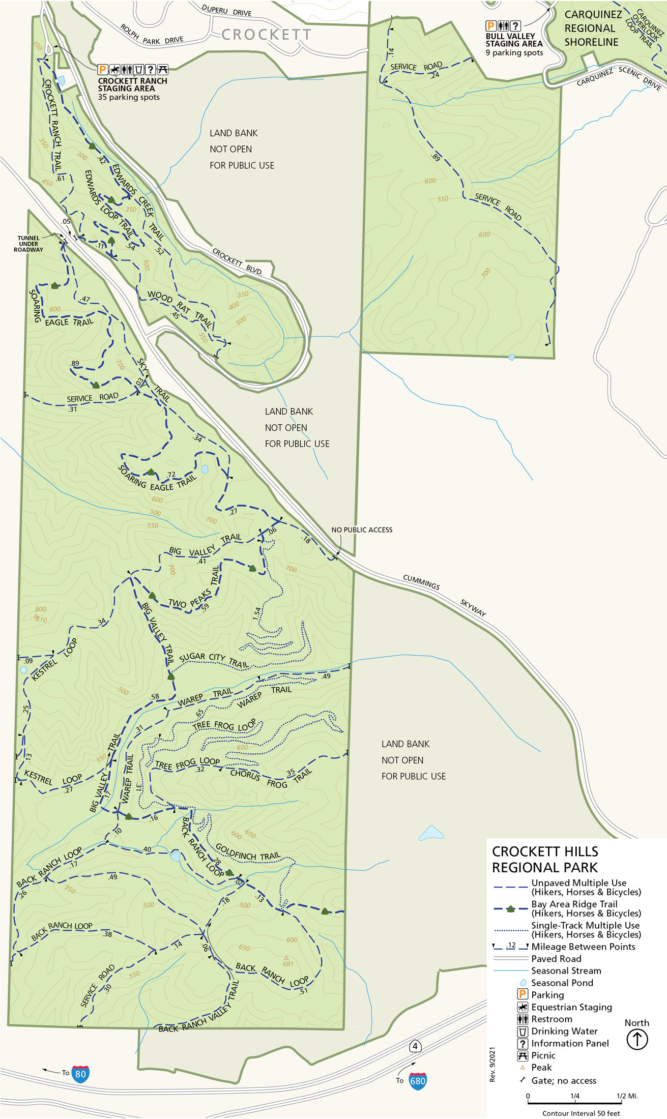
Attractions
Vegetation
The major plant communities that occur in Crockett Hills Regional Park includes plant species typical of annual grassland, oak woodland, and coastal scrub vegetation. Localized wooded communities composed of oak and oak/bay woodland and buckeye can be found in protected east-facing slopes and ravines.
Wildlife
The park's grasslands provide habitat to western meadowlark, horned lark, house finch, western bluebird, and American goldfinch. Valley oaks offer perches and nest sites for the red-tailed hawk, American kestrel, golden eagle, northern harrier, great horned owl, and barn owl. Cooper's hawks depend on the riparian ravines for nesting and for providing cover for ambushing prey. Mammals include the gray fox, mule deer, raccoon, eastern fox squirrel, Botta's pocket gopher, and other species. Small rodents are prey to gopher snakes, sharp-tailed snakes, and western garter snakes.
Park Activities
Hiking, running, biking, dog walking and horseback riding are some of the popular activities in the park. There are picnic tables at the Crockett Ranch Staging Area.